
Landmarks
Take a visual walk thru the past
|
Landmarks Take a visual walk thru the past |
|
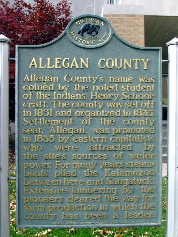 Allegan County Inscription: Allegan County's name was coined by the noted student of the Indians, Henry Schoolcraft. The county was set off in 1831 and organized in 1835. Settlement of the county seat, Allegan, was promoted in 1835 by eastern capitalists who were attracted by the site's sources of water power. For many years steamboats plied the Kalamazoo between here and Saugatuck. Extensive lumbering by the pioneers cleared the way for farm production in which the county has been a leader. Location: Intersection of Chestnut Street and Hubbard Street, on the right when traveling south on Chestnut Street |
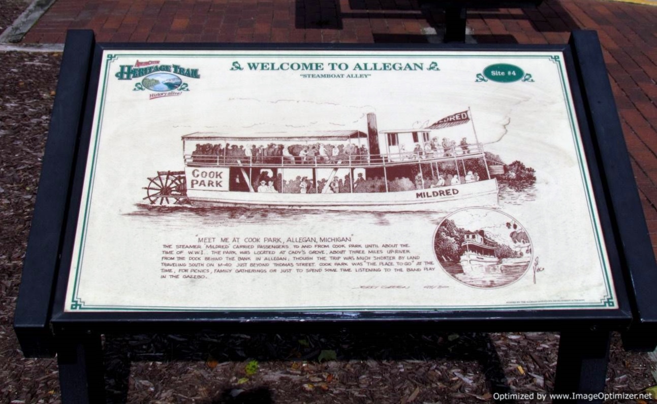 Allegan County Welcome Inscription: "MEET ME AT COOK PARK, ALLEGAN, MICHIGAN" The steamer Mildred carried passengers to and from Cook Park until about the time of W.W.I. The park was located at Cady's Grove, about three miles upriver from the dock behind the bank in Allegan, though the trip was much shorter by land traveling south on M-40 just beyond Thomas Street. Cook Park was "the place to go" at the time, for picnics, family gatherings or just to spend some time listening to the band play in the gazebo. Location: Riverfront Plaza west of Brady Street, on the right when traveling east |
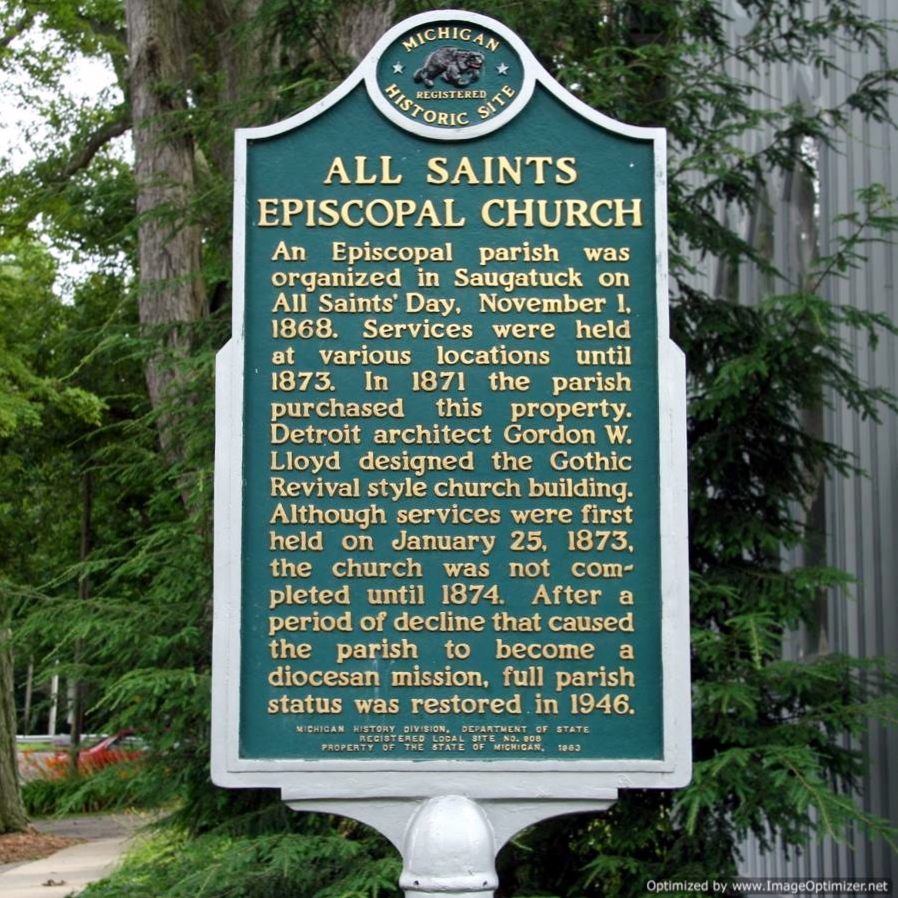 All Saints Episcopal Church (In Saugatuck) Inscription: An Episcopal parish was organized in Saugatauk on All Saints Day, November 1, 1868. Services were held at various locations until 1873. In 1871 the parish purchased property. Detroit architect Gordon W. Lloyd designed the Gothic Revival-style church building. Although services were first held on January 25, 1873, the church was not completed until 1874. After a period of decline that caused the parish to become a diocesan mission, full parish status was restored in 1946. Location: Intersection of Grand Street and Hoffman Street, on the left when traveling north on Grand Street |
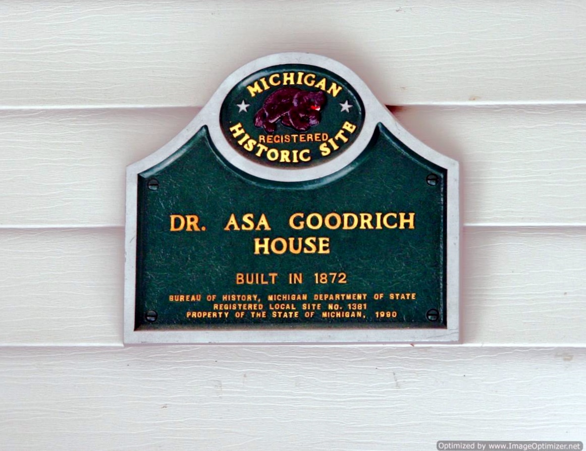 Dr. Asa Goodrich House (In Douglas) Inscription: Dr. Asa Goodrich House Built in 1872 Location: Intersection of West Center Street and Mixer Street. Marker is affixed to the front of the residence and is difficult to see from the street. Left side of Center Street as you are eastbound |
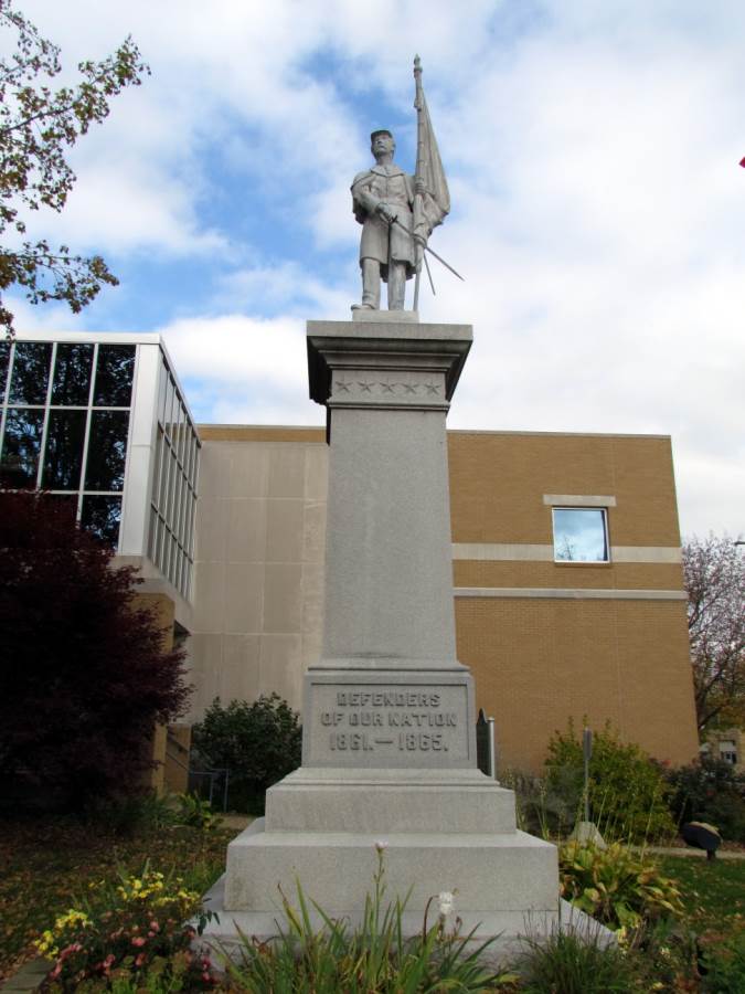 Civil War Inscription: Defenders of our Nation 1861. — 1865 Location: intersection of Hubbard Street and Chestnut Street, on the right when traveling west on Hubbard Street. |
 Douglas Inscription: Douglas began as two communities separated by present day Center Street. Jonathan Wade platted Dudleyville, named for his brother Dudley Wade, on the south side of "Centre" in 1860. In 1861, William F. Dutcher platted the town of Douglas on the north side of Centre. Dutcher named it for his hometown on the Isle of Man in the Irish Sea. The original plat consisted of the area bounded by Union, Chestnut, Water and Centre Streets. The two towns were incorporated as the village of Douglas in 180. Dutcher's son Thomas, a prosperous lumber mill owner built a three-story commercial and residential structure downtown. Location: intersection of Center Street and Union Street, on the left when traveling east on Center Street. |
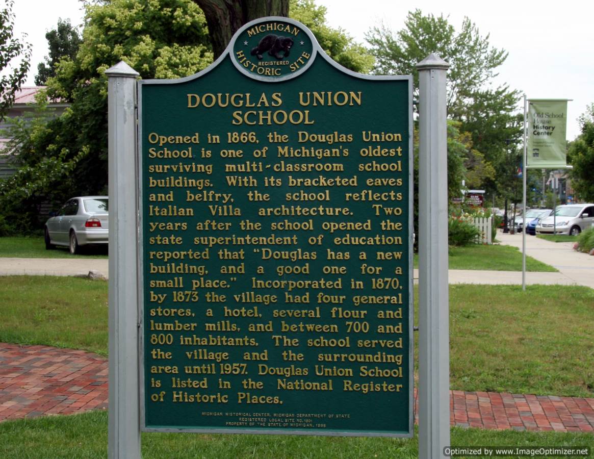 Douglas Union School (In Douglas) Inscription: Side 1 In 1866, faced with the growth of what were then separate villages of Douglas and Dudleyville, Saugatauk Township District No. 3 and 4 merged to form Union District No. 3. The Douglas Union School opened for classes in September 1866. One male and one female teacher taught 129 pupils that year. Early newspapers reported church services, concerts and social events taking place in the building's second floor hall. When it closed in 1957, the school had four classrooms. They were converted to apartments during the 1960s. The bell, made by the Buckeye Bell Foundry of Cincinnati was removed and relocated to the new elementary school. Side 2 Opened in 1866, The Douglas Union School is one of the oldest surviving multi-classroom school buildings. With its bracketed eaves and belfry, the school reflects Italian Villa architecture. Two years after the school opened the state superintendent of education reported that "Douglas has a new building, and a good one of a small place." Incorporated in 1870, by 1873 the village had four general stores, a hotel, several flour and lumber mills, and between 700 and 800 inhabitants. The school served the village and the surrounding area until 1957. Douglas Union School is listed in the National Register of Historic Places. Location: Intersection of Center Street and Mixer Street, on the left when traveling east on Center Street |
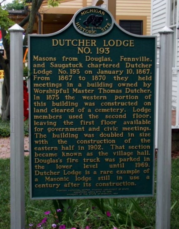 Dutcher Lodge No. 193 (In Douglas) Inscription: Masons from Douglas, Fennville, and Saugatauk chartered Dutcher Lodge No. 193 on January 19, 1867. From 1867 to 1870 they held meetings in a building owned by Worshipful Master Thomas Dutcher. In 1875, the western portion of this building was constructed on land cleared of a cemetery. Lodge members used the second floor, leaving the first floor available for government and civic meeting. The building was doubled in size with the construction of the eastern half in 1902. That section became known as the village hall. Douglas's fire truck was parked in the lower level until 1969. Dutcher Lodge is a rare example of a Masonic lodge still in use a century after its construction. Location: intersection of Center Street and Union Street, on the left when traveling east on Center Street. |
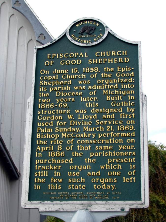 Episcopal Church of Good Shepherd Inscription: On June 15, 1858, the Episcopal Church of the Good Shepherd was organized; its parish was admitted into the Diocese of Michigan two years later. Built in 1866-69, this Gothic structure was designed by Gordon W. Lloyd and first used for Divine Service on Palm Sunday, March 21, 1869. Bishop McCoskry performed the rite of consecration on April 8 of that same year. In 1886 the parishioners purchased the present tracker organ which is still in use and one of the few such organs left in this state today. Location: Intersection of Walnut Street and Hubbard Street, on the right when traveling south on Walnut Street |
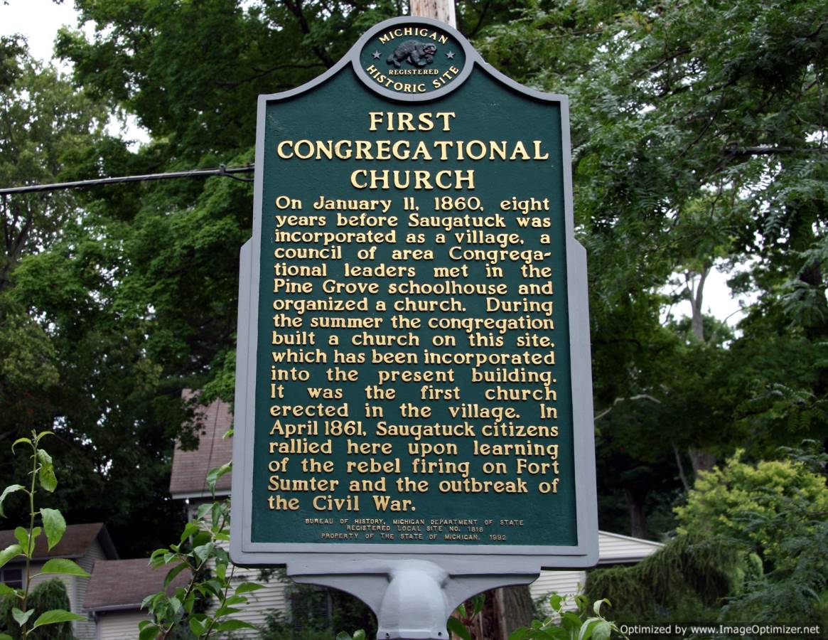 First Congregational Church (In Saugatuck) Inscription: On January 11, 1860, eight years before Saugatuck was incorporated as a village, a council of area Congregational leaders met in the Pine Grove schoolhouse and organized a church. During the summer the congregation built a church on this site, which has been incorporated into the present building. It was the first church erected in the village. In 1861, Saugatuck citizens rallied here upon learning of the rebel firing on Fort Sumter and the outbreak of the Civil War. Location: Intersection of Hoffman Street and Griffith Street, on the left when traveling east on Hoffman Street. |
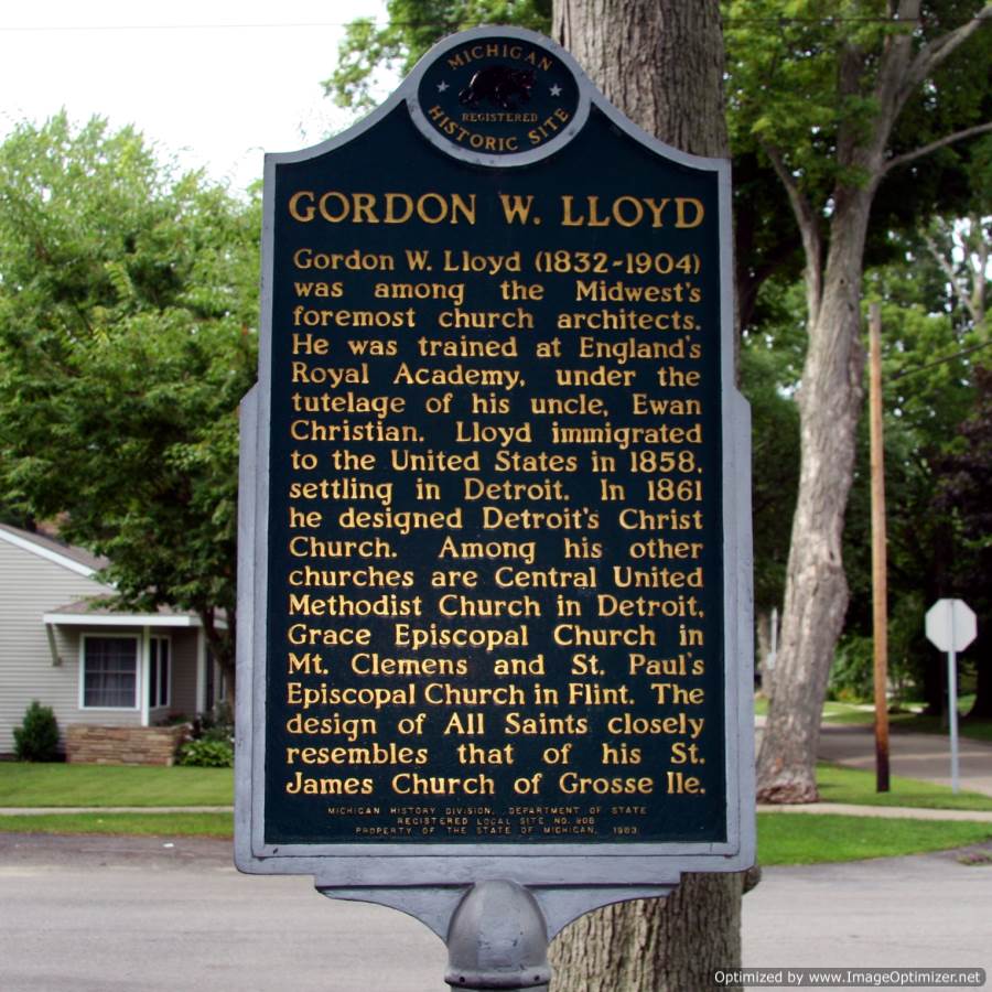 Gordon W. Lloyd (In Saugatuck) Inscription: Gordon W. Lloyd (1832-1904) was among the Midwest's foremost church architect. He was trained at England's Royal Academy under the tutelage of his uncle, Ewan Christian. Lloyd immigrated to the United States in 1858, settling in Detroit. In 1861 he designed Detroit's Christ Church. Among his other churches are Central United Methodist Church in Detroit, Grace Episcopal Church in Mount Clemens and St. Paul's Episcopal Church in Flint. The design of All Saints closely resembles that of his St. James Church of Grosse Ile. Location: Intersection of Grand Street and Hoffman Street, on the left when traveling north on Grand Street |
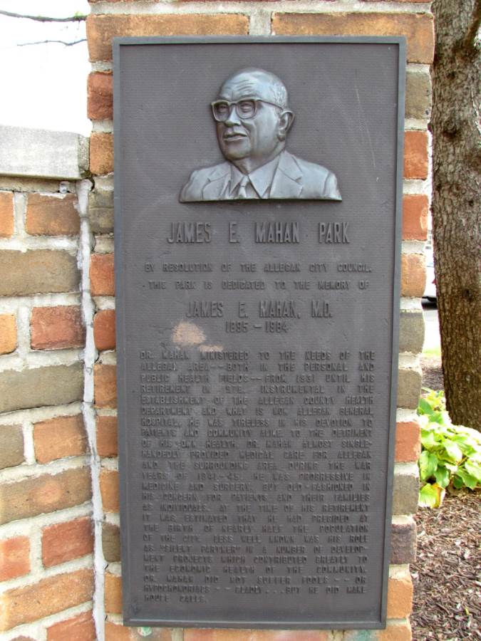 James E. Mahan M.D Inscription: By resolution of the Allegan City Council, this park is dedicated to the memory of 1895–1984 Dr. Mahan ministered to the needs of the Allegan area -- both in the personal and public health fields -- from 1931 until his retirement in 1978. Instrumental in the establishment of the Allegan County Health Department and what is now Allegan General Hospital, he was tireless in his devotion to patients and community alike. To the detriment of his own health, Dr. Mahan almost single-handedly provided medical care for Allegan and the surrounding area during the war years of 1941-45. He was progressive in medicine and surgery, but old-fashioned in his concern for patients and their families as individuals. At the time of his retirement it was estimated that he had presided at the birth of nearly half the population of the city. Less well known was his role as "silent partner" in a number of development projects which contributed greatly to the economic health of the community. Dr. Mahan did not suffer fools -- or hypochondriacs -- gladly ... but he did make house calls. Location: Brady Streeteast of Riverfront Plaza, on the right when traveling east. |
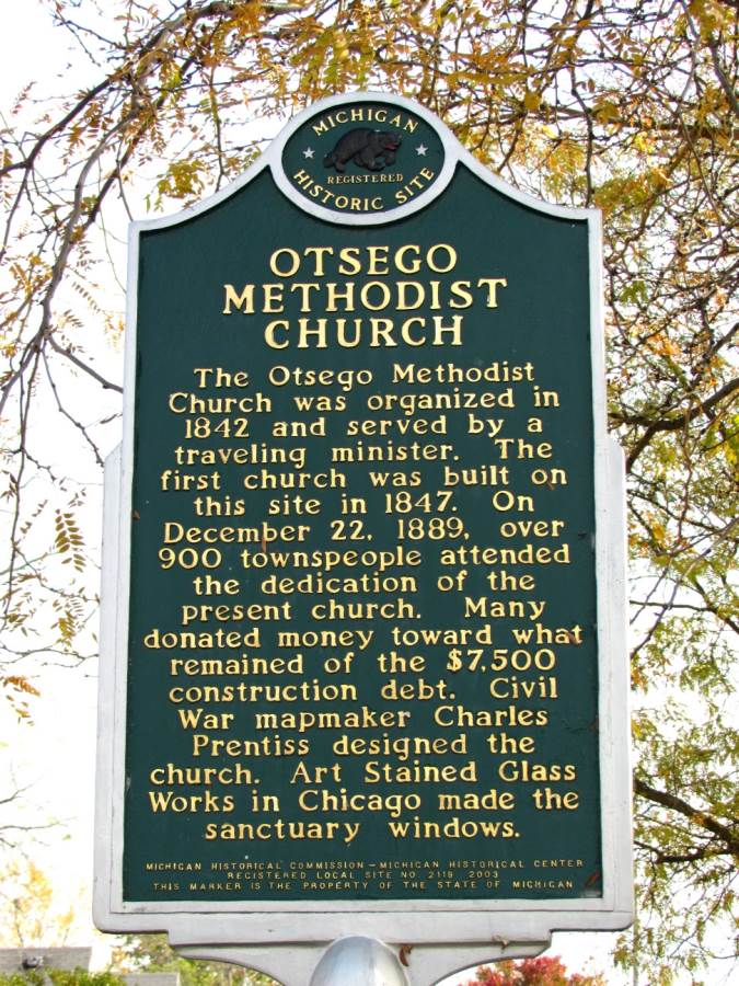
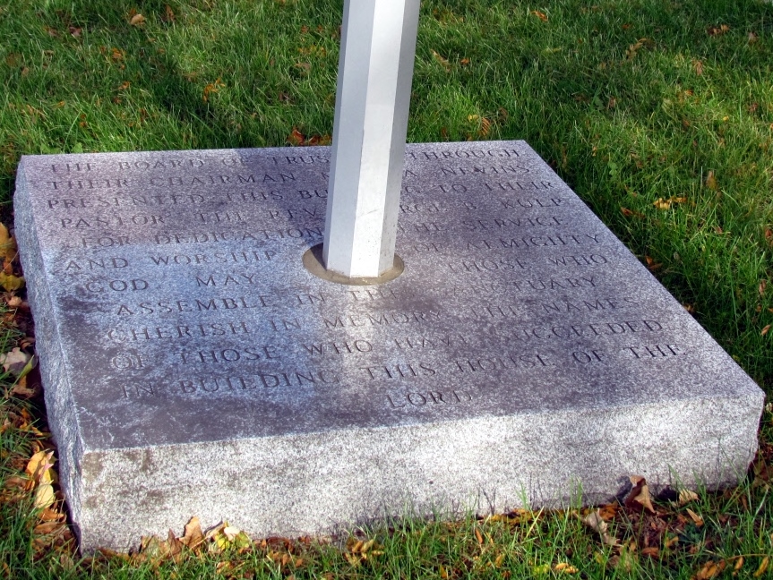 Otsego Methodist Church (In Otsego) Inscription: The Otsego Methodist Church was organized in 1842 and served by a traveling minister. The first church was built on this site in 1847. On December 22, 1889, over 900 townspeople attended the dedication of the present church. Many donated money toward what remained of the $7,500 construction debt. Civil War mapmaker Charles Prentiss designed the church. Art Stained Glass Works in Chicago made the sanctuary windows. The base of the marker is inscribed with the following text: "The Board of Trustees through their chairman Mr. B.A. Nevins presented this building to their pastor the Rev. George B. Kulp for dedication to the service and worship of almighty God. May those who assemble in this sanctuary cherish in memory the names of those who have succeeded in building this House of the Lord." Location: E. Allegan Street (Michigan Route 89) east of N. Fair Street, on the left when traveling east. |
 Reed's Livery (In Saugatuck) Inscription: Roger E. Reed, whose father was a blacksmith and carriage maker, built this structure in 1905. The front of the building housed an office and carriages, while the back was a stable of 25 stalls. Here travelers boarded stages bound for Holland, Grand Rapids, or Allegan, and customers rented horses and wagons. The cement block building was hailed as modern and fireproof, and it served as the village fire station during the 1950s. An Eskimo Pie factory was among the manufacturers once located here. Location: Intersection of Culver Street and Griffith Street, on the right when traveling west on Culver Street. affixed to the east wall of the building, facing Griffith Street. It is clearly visible when traveling either direction on Griffith, or when westbound on Culver Street. Marker is hidden from view when traveling eastbound on Culver Street. Marker can be easily accessed on the sidewalk |
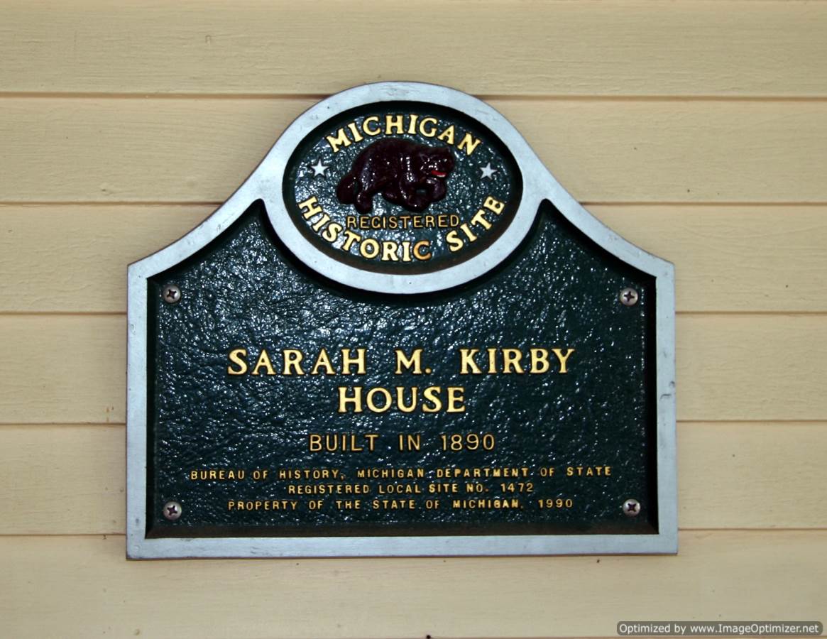 Sarah M. Kirby House (In Douglas) Inscription: Sarah M. Kirby House Built in 1890 Location: intersection of W. Center Street and Blue Star Highway. affixed to the front of building on front porch. |
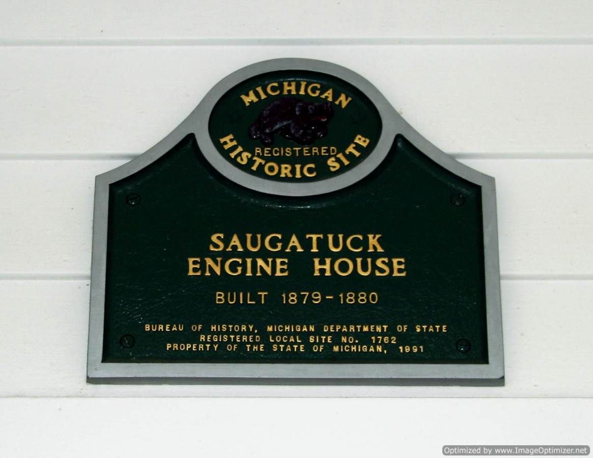 Saugatuck Engine House (In Saugatuck) Inscription: Saugatuck Engine House Built 1879-1880 Location: Intersection of Butler Street and Culver Street, on the left when traveling north on Butler Street. Marker is at the same location, in front lawn of building |
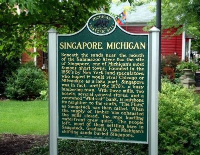 Singapore, Michigan Inscription: Beneath the sands near the mouth of the Kalamazoo River lies the site of Singapore, one of Michigan's most famous ghost towns. Founded in the 1830's by New York land speculators, who hoped it would rival Chicago or Milwaukee as a lake port, Singapore was in fact, until the 1870's, a busy lumbering town. With three mills, two hotels, several general stores, and a renowned "Wild-cat" bank, it outshone its neighbor to the south, "The Flats," as Saugatauk was then called. When the supply of timber was exhausted the mills closed, the once bustling waterfront grew quiet. The people left, most of them settling here in Saugatauk. Gradually, Lake Michigan's shifting sand buried Singapore. Location: intersection of Butler Street and Culver Street, on the left when traveling north on Butler Street. |
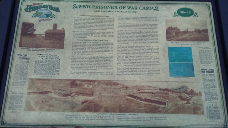 WWI Prisoner of War Camp (in Allegan) Inscription: Camp Lakewood was built in Army Camp style in 1936. The blueprints are dated April 2, 1936 and were revised on June 16, 1936. The camp had bunkhouses, a mess hall and kitchen building, shower and wash building, garage, warehouse, headquarters and a first aid building. Also in camp was a well-house and a elevated water tower. Each building had a fire hydrant and water distribution and septic system. Location: South of Allegan Dam Road, north of Monroe Road, on the east side of 42nd Street, west of Lake Allegan in Allegan. |
 Return To Home Page


All rights reserved.
This site may be freely linked to but not duplicated
in any fashion without my consent.
The information on these pages is meant for personal genealogical
research only and is not for commercial use of
any type.
| Top of Page |