Photos Included in
A Citizen's History of Grand Rapids
Campau Centennial
September 23 - 26, 1926
|
Page 38
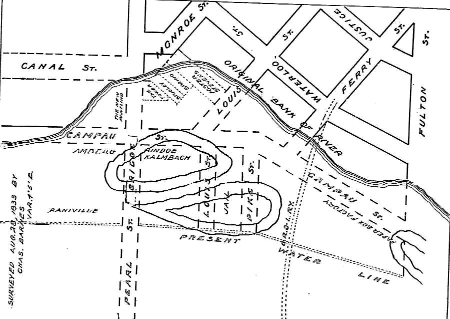
Surveyed August 28, 1833 by Charles Barnes
Map showing old and present banks of the river, with locations
of Islands Nos. 1 and 2. It also shows how Campau avenue is almost wholly
on the old river bed and that the jail is on Island No. 2. Waterloo street
is the present Market avenue. Map makes plain the double turn connecting
old Monroe avenue and Canal street before Campau square came into existence.
Buildings which occupied the triangle between Monroe and Canal were torn down in
1873. Ferry street received its name because in olden days, at its western
end, there was a ferry across the river.
|
| |
|
Page 52
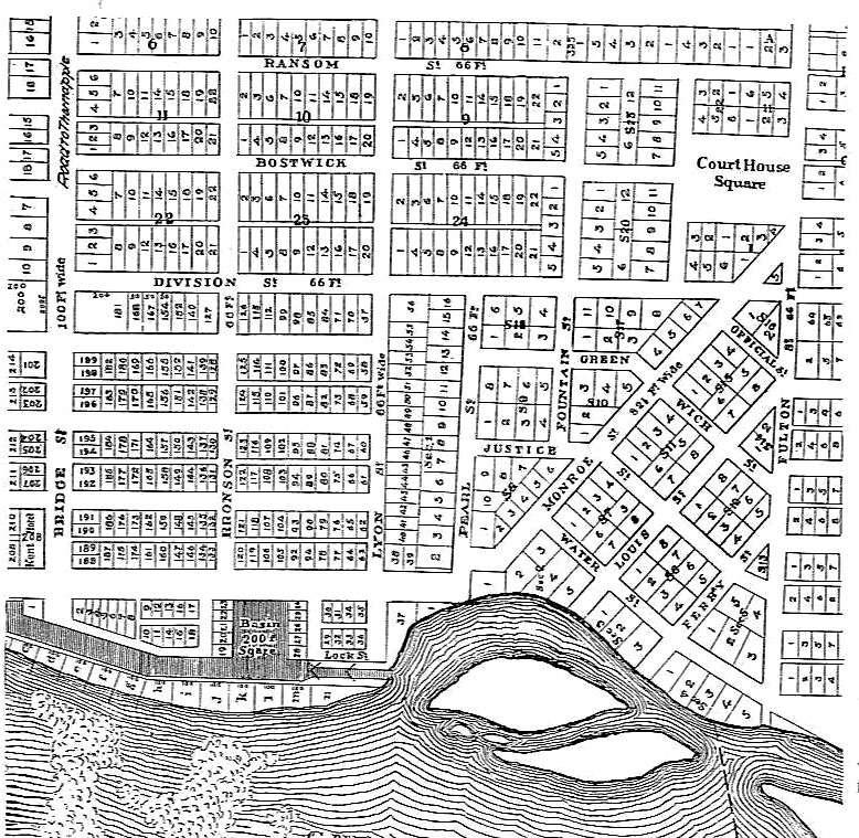
Early map from the city engineer's office, referred to in the
chapter, "Grand Rapids or Kent?"
|
| |
|
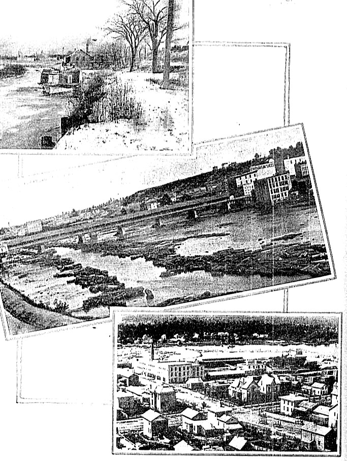
Page 60
-
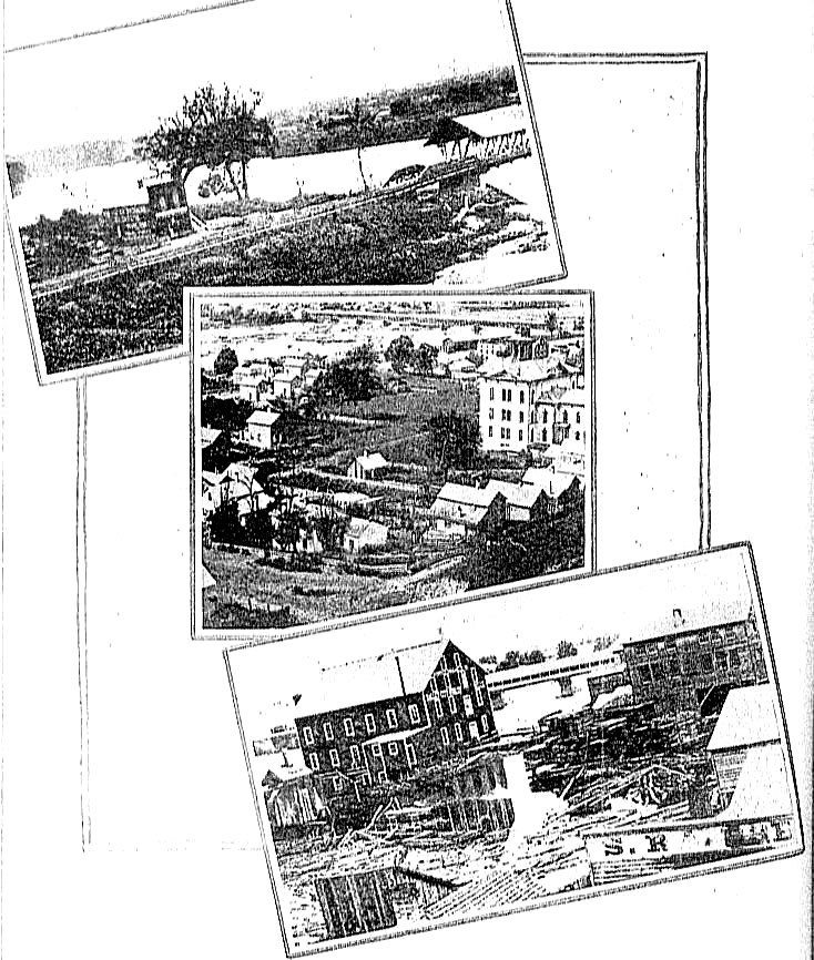
Top - The first Pearl street bridge, built in 1858.
The photo shows east end of bridge then on Island No. 1. Embankment,
with protecting fence, runs eastward across island, to steamboat channel,
which was crossed by a separate bridge. East bank of river is now near
the middle of the first span of bridge pictured.
-
Middle - The view up river from the hill. First
Leonard street bridge, built in 1858. Right foreground, old Ionia
street school. Behind the school tower is Tanner Taylor's tannery and
just beyond C. C. Comstock's famous "row," first multiple apartment in city,
built to house negroes who worked in Comstock mills.
-
Bottom - View about 1865 of woolen mill bu8ilt 1857, on site
of present Bissell carpet sweeper factory. Toll bridge at Bridge
street in background, part of old canal basin in foreground. Building
at right was a cabinet shop, operated by Buddington & Thornton.
Bissell offices are now there.
|
| |
|
Page 76
-
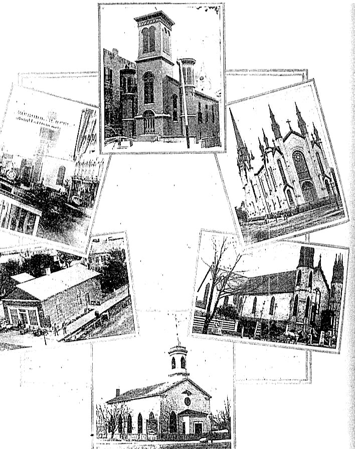
Top - Universalist church, built 1868; site of present
Association of Commerce building.
-
Upper left - View up Monroe avenue in 1864. Luce's
block right. Old stone St. Andrew's Catholic church, built 1849-50,
across Ottawa avenue from Luce's block. Across Monroe avenue is sign:
"Lincoln and Johnson - Freedom and the Union."
-
Upper right - First Methodist church, Division and Fountain.
Built 1868-69.
-
Lower left - First St. Mark's Episcopal church, built
northwest corner Division and Crescent. As first erected in 1841 it
was 27 by 41 feet, but in 1844 it was enlarged by cutting the structure in
two and inserting a section 20 feet in length.
-
Lower right - Present St. Mark's, occupied in 1848.
View shows structure, somewhat enlarged in 1865. Two front doors then.
-
Buttom - Louis Campau built this church at Monroe and
Division in 1837 for use by the Catholics. Congregationalists bought
it. Burned November 26, 1872.
|
| |
|
Page 84
-
Top - Looking up east channel of Grand river about 1890.
Warehouse on dock, directly above boat, and enlarged north end of channel,
are now covered by the Island Park baseball grounds.
-
Middle - Looking up river from Pearl toward Bridge street
bridge in logging days, about 1875.
-
Bottom - Looking across river from the hill above Sixth
street bridge. Observe the old curved wing dam built 1849.
Present dam was constructed in 1866, further down stream. Newberry
street in foreground, and one of the old lime kilns at right, on river bank.
|
| |
|
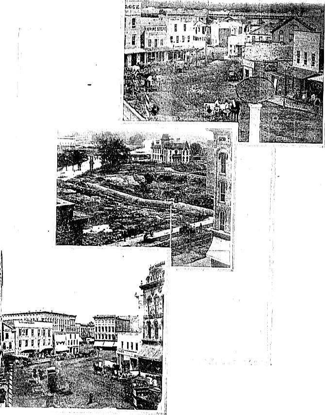
Page 96
-
Top - Foot of Monroe avenue in 1852, taken from Market
avenue. Town flage pole in middle is on south side of Pearl street.
Hall book store, Joseph Martin's grocery, and Powers & Ball's furniture
store are the three buildings on pearl street, to right of pole.
One-story building on right, with swinging sign of a bull in front, is Joel
Guild's home, made over into a meat market. This house was built in
1833 on first lot Louis Campau sold.
-
Middle - Looking across old east river channel to jail on
Island No. 2 - 1872. Filling of channel began in 1868 and tail race
for Butterworth & Lowe water wheel at end of canal shows center. Mud
hole lower left is site of Fourth National Bank building.
-
Bottom - Foot of Monroe avenue in 1870, before the five
buildings in front center were torn down to create Campau square.
Stone Commercial block, with figure 2 on it, was built in 1844. Right
of it is Crawford's famous checkered store. Sweet's Hotel (Pantlind)
shows behind row of five stores.
|
| |
|
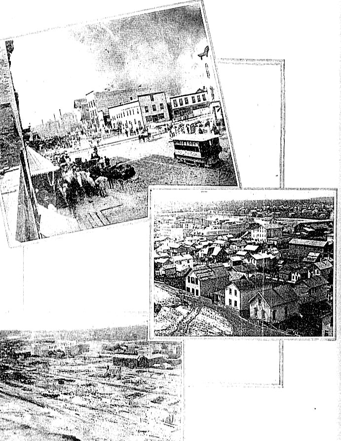
Page 100
-
Top - Big fire of July 13, 1873, which destroyed most of the
structures between upper Monroe and Ionia avenues, north of Michigan street.
View is north and east from Monroe and Michigan. Fire was still
burning when the photograph was taken.
-
Middle - Some of the buildings destroyed in the 1873 fire.
View is from the bluff, towards south and west. Bridge street bridge
on the upper right, Pearl street bridge below.
-
Bottom - View from same spot, after the fire. Smoke is
rising from Sweet's big mill.
|
| |
|
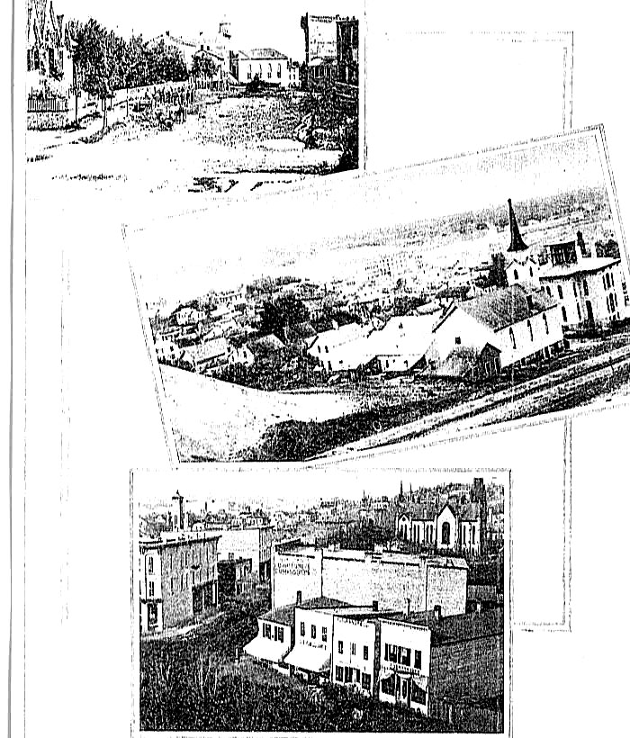
Page 106
-
Top - View south in Ottawa avenue, from Pearl street to
Monroe avenue, 1865. The street is being graded the second time, level
of first grade (1857) showing along fence on left. Teams working in
front of present Michigan Trust building site. In distance is old St.
Andrew's Catholic church, south side of Monroe avenue. Soil removed
was used to fill frog pond where postoffice now stands, and creek valley
under city hall.
-
Middle - View from near top of Michigan street hill.
Old Butterworth hospital was built on the sand pile at lower left.
Immanuel Lutheran church lower right and school house to its right with
scaffolding still on tower. Islands showing in left distance.
-
Bottom - View taken about 1880 from present Herald building
site. Structures in foreground are on north side of Monroe avenue, at
Division avenue corner. Across Division, at left, is Peck's drug
store. In background First Methodist church. Observe street car
tracks on Division.
|
| |
|
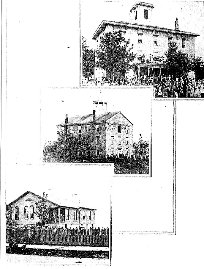
Page 110
-
Top - School built 1849 of river limestone on site of
present Union High. Third floor first used for an armory. Torn
down 1872.
-
Middle - "Old Stone School House," built 1849 at Ransom
avenue and Lyon street, on site of present Junior College.
-
Bottom - No. 2 Primary School on South Division avenue.
Torn down 1884. Land on which it stood cost $500 in 1861.
|
| |
|
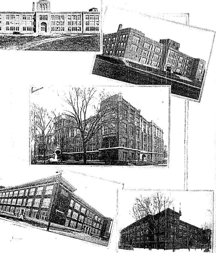
Page 114
-
Top Left - Ottawa Hills Junior High School
-
Top Right - Creston High School
-
Middle - Central High School
-
Bottom Left - South High School
-
Bottom Right - Union High School
|
| |
|
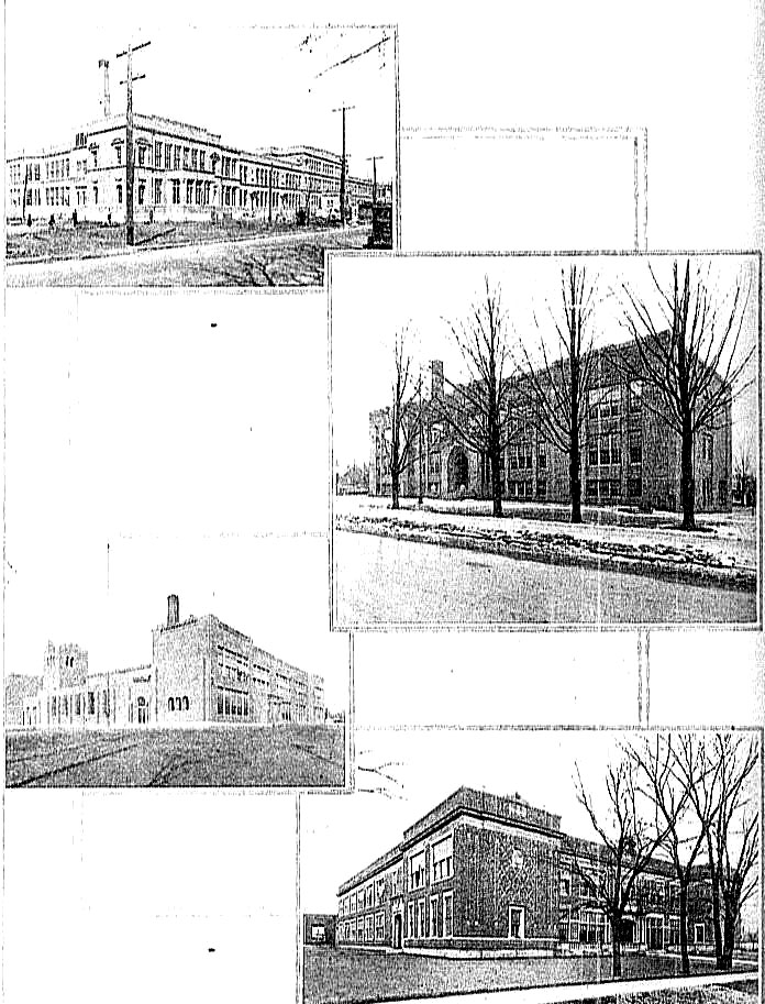
Page 118
-
Top - Burton School, ready for occupancy in 1926
-
Middle Left - Stocking School
-
Middle Right - Lafayette School
-
Bottom - Sibley School
|
| |
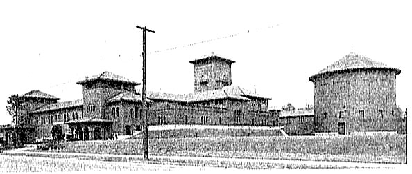
Page 127
Grand Rapids City Filtration Plant
Completed January 1, 1913. Addition in 1923.
Capacity of 40,000,000 gallons.
|
Page 134
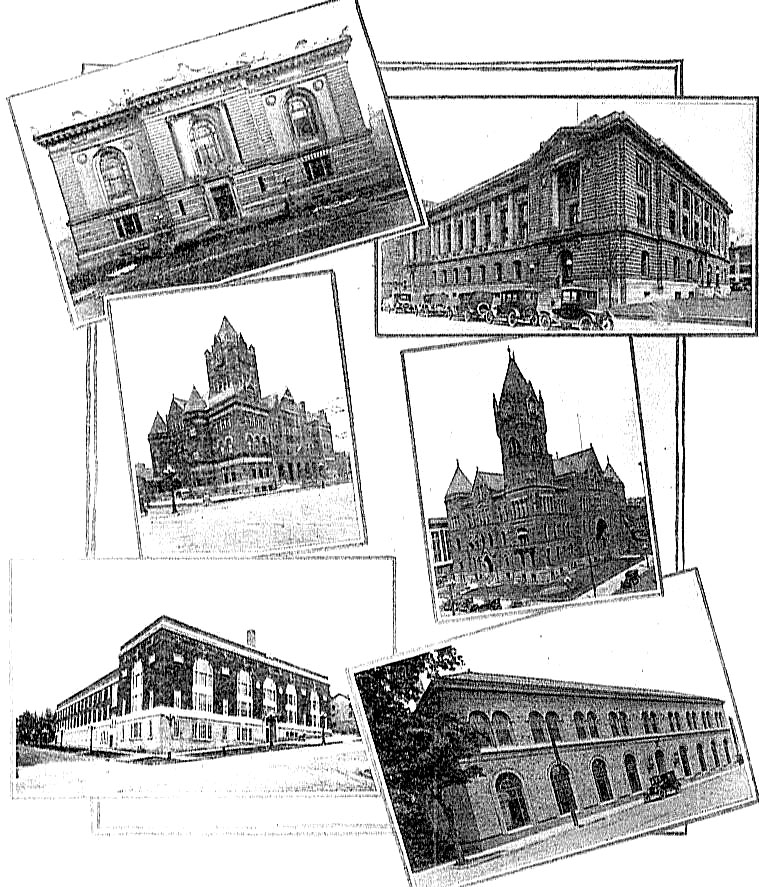
-
Top left - Ryerson Public Library, Gift of Martin Antoine
Ryerson of Chicago
-
Top right - Federal building - Postoffice
-
Middle left - County building, erected 1889-90
-
Middle right - City Hall, built 1889
-
Bottom left - Armory
-
Bottom right - West side branch Public Library, completed
1926
|
| |
|
Page 140
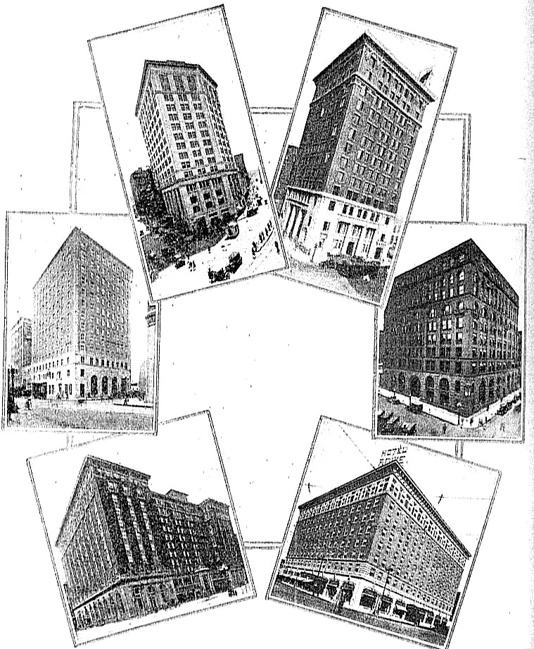
-
Top left - Grand Rapids National Bank building, Campau
Square. Upper floors built 1925-26.
-
Top right - Grand Rapids Savings Bank building.
-
Middle left - Morton Hotel including home of Kent State Bank
-
Middle right - Michigan Trust Company building. City's
first skyscraper
-
Bottom left - Hotel Pantlind. Old National bank in
left corner, branch of Kent Savings in right corner.
-
Bottom right - Hotel Rowe
|
| |
|
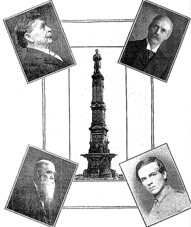
Page 146
-
Top left - Captain Charles E. Belknap, soldier, city
fireman, manufacturer, congressman, mayor, good citizen - 80 years young.
-
Top right - Israel Canton Smith, enlisted as a private in
Co. E., Old Third Infantry. Became Brevet Brigadier General.
-
Middle - Civil War memorial, Monument Park.
-
Bottom Left - Byron R. Pierce. Helped to
organize Old Third Infantry. Captain in that regiment. Promoted
to brigadier-general of Volunteers and brevet major-general, highest office
attained by any Michigan soldier in Civil War.
-
Bottom right - Fred S. Church, Civil War veteran.
Artist of international fame.
|
| |
|
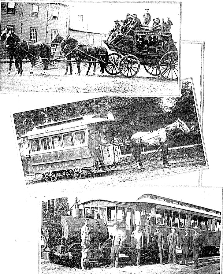
Page 154
-
Top - Stage coach running between Grand Rapids and
Kalamazoo, 1855 to 1868. Photograph taken in 1865.
-
Middle - Horse car on the Valley City Street and Cable
company's lines, completed in 1885. Sign at top reads: "waterloo,
Fulton and Straight."
-
Bottom - Engine that pulled cars over the famous old "dummy"
line, out Sherman street from Eastern avenue to Reed's lake, in the 1870's
and 1880's. George E. Fitch says: "Fare collected before you entered
the car and cinders in your eye guaranteed."
|
| |
|
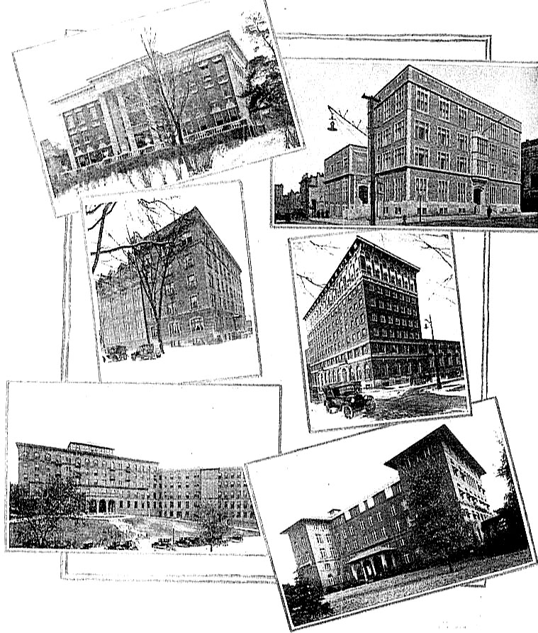
Page 162
-
Top left - D. A. Blodgett Home for Children
-
Top right - Young Women's Christian Association building
-
Middle left - St. Mary's Hospital
-
Middle right - Young Men's Christian Association building
-
Bottom left - New Butterworth Hospital
-
Bottom right - Blodgett Memorial Hospital
|
| |
| |
|
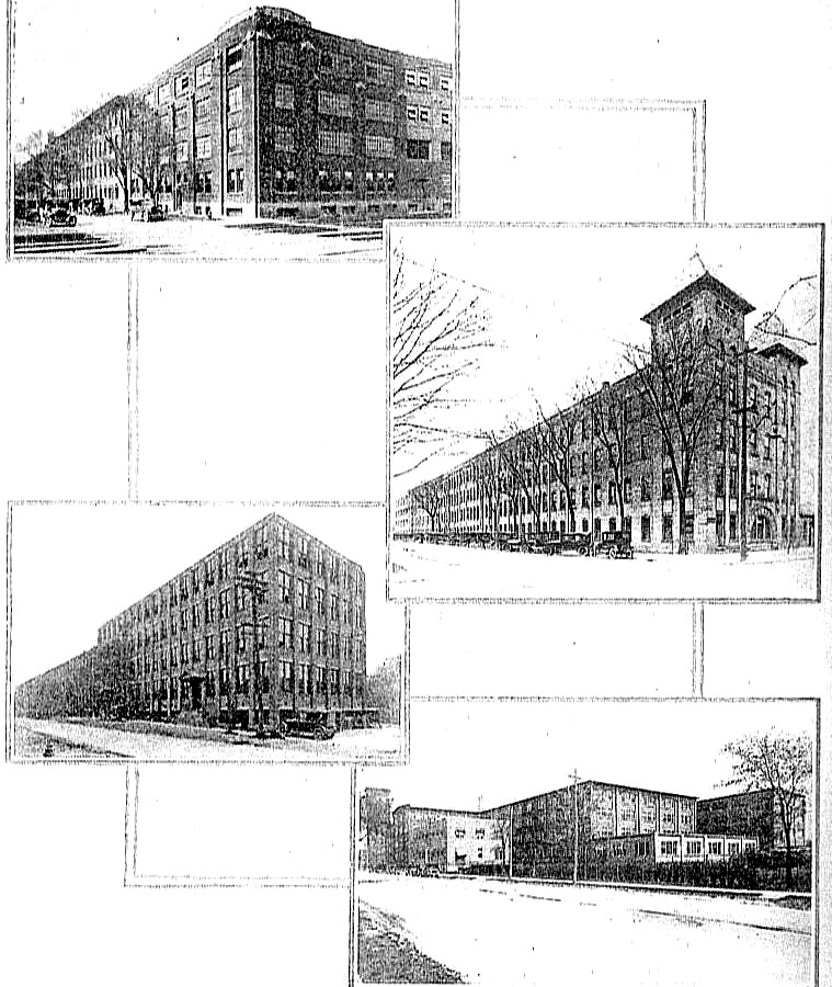
Page 172
-
Top - Furniture plant of the Robert W. Irwin company
-
Middle left - Grand Rapids Refrigerator company's plant.
Capacity soon to be doubled.
-
Middle right - American Seating company's factory.
Extensive new buildings now being erected.
-
Bottom - Imperial Furniture company's factory.
|
|
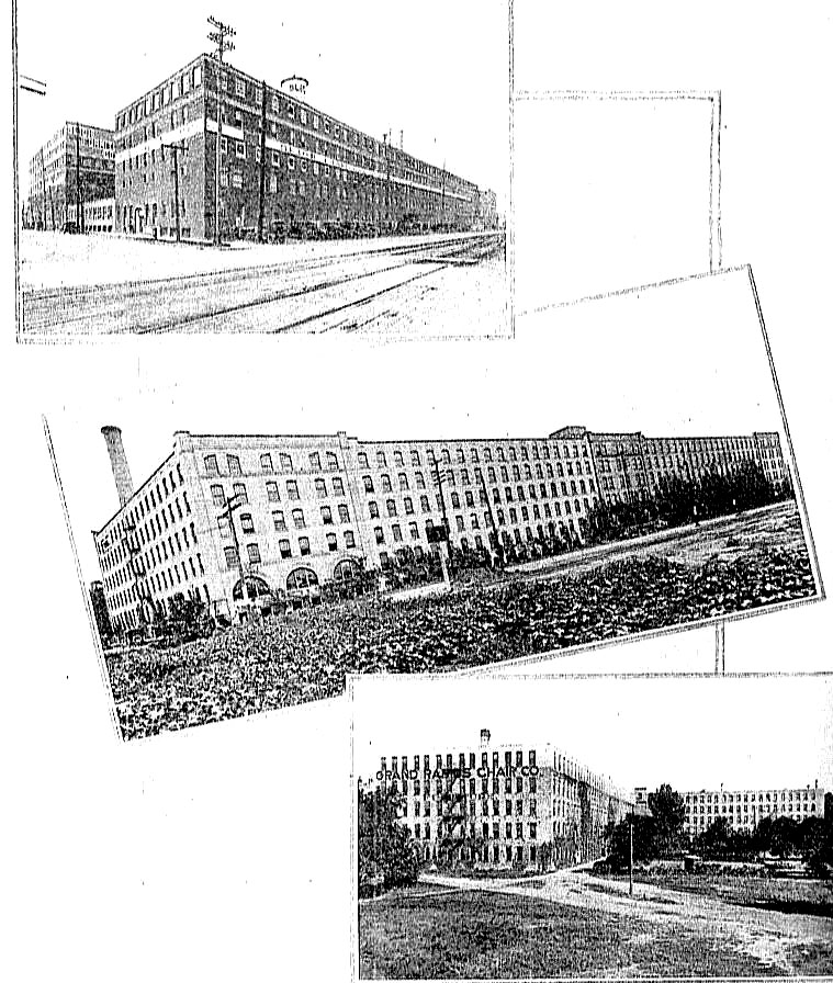
Page 176
-
Top - Sligh Furniture company's extensive plant.
-
Middle - Portion of the Berkey & Gay Furniture company's
factories.
-
Bottom - Two wings of the Grand Rapids Chair company's
plant, built around an attractive miniature park.
|
|
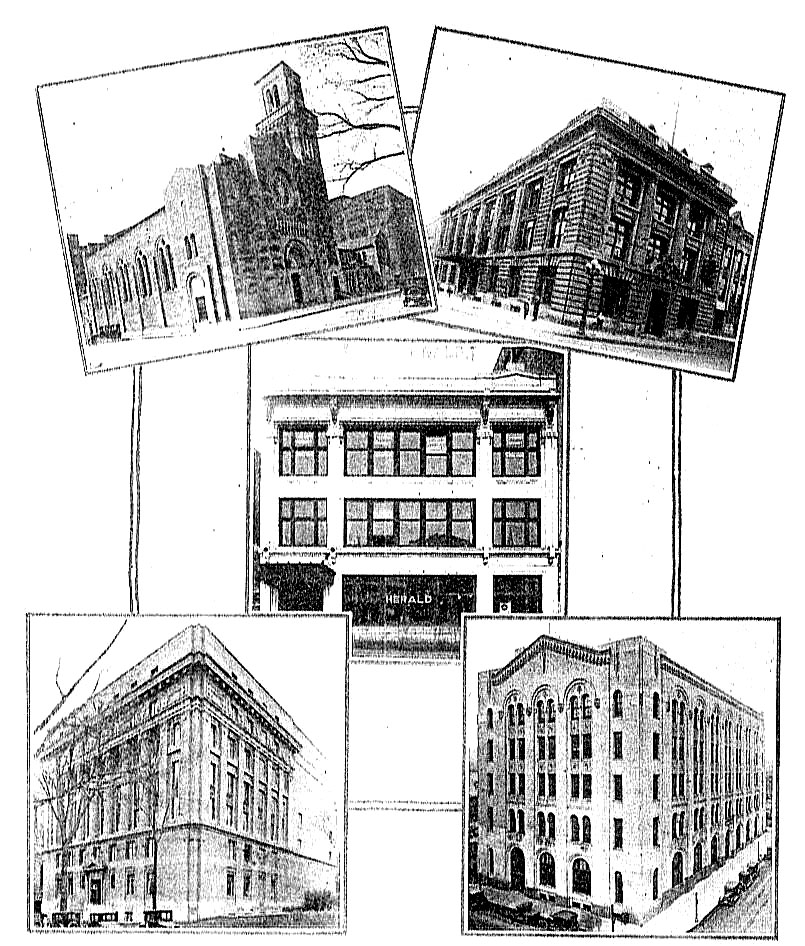
Page 188
-
Top Left - Fountain Street Baptist Church, completed in 1924
-
Top Right - Grand Rapids Press building
-
Middle - Grand Rapids Herald building
-
Bottom Left - Masonic Temple
-
Bottom Right - Michigan Bell Telephone Company building,
completed 1926
|
| |
Created: 27 May 2008